Over the years I have been lucky enough to be allowed to chronicle the development of the Atlanta Beltline. I’ve been to the Eastside Trail countless times, the Westside Trail in all of its stages of development and now that they have announced the start of the Southside Trail I jumped at the chance to take the four-point-something mile hike through overgrown grass, under overpasses and tunnels, over rickety bridges once used by trains all the way from University Ave. to Glenwood Ave. It was a mix of man made objects and the struggle between man and nature as nature, at least for the time being, is retaking the unused rail line and surrounding easement. That will change all too soon but in the meantime, the trail is still closed, even to interim hiking until safety precautions have been put into place. Speaking from experience some of the aforementioned rickety bridges are pretty sketchy…until then explore the trail through photographs.
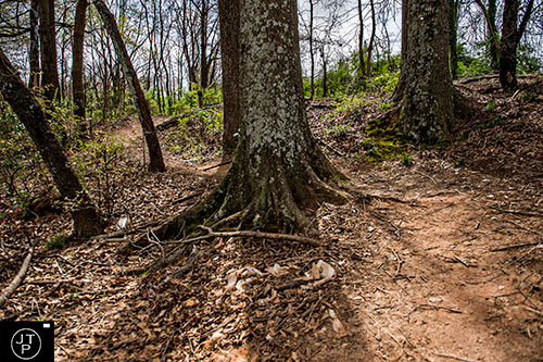
An unassuming dirt trail off of University Ave. leads up to beginning of the Southside Trail following the CSX rail line.
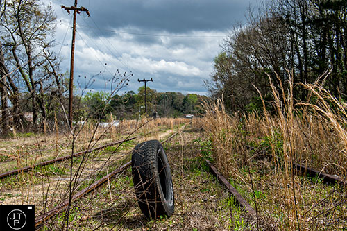
An old tire marks the beginning of the Southside Trail which will be 4.5 miles leading all the way down to Glenwood.
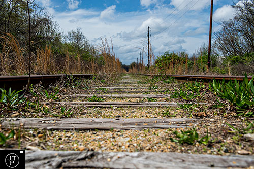
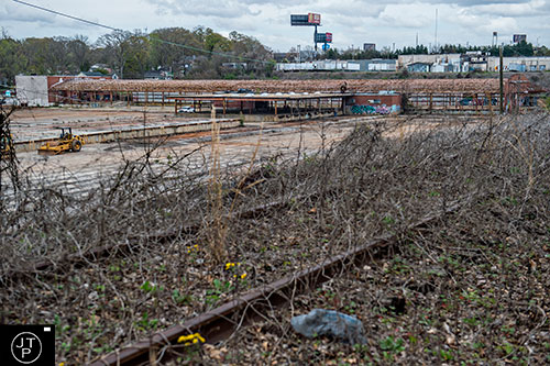
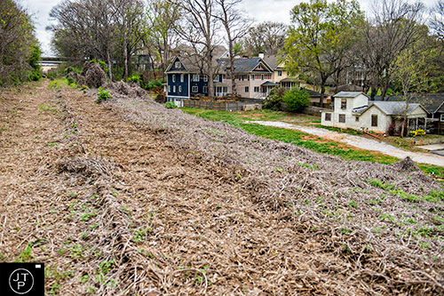
The tracks along the 4.5 mile stretch between University and Glenwood will be taken up and a concrete trail will eventually replace the path.
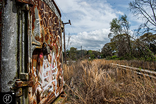
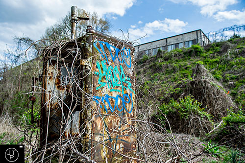
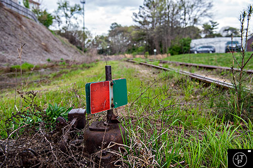
An old switch box covered in rust and graffti along the Southside Trail.
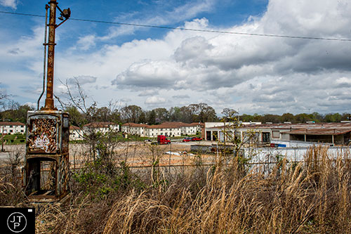
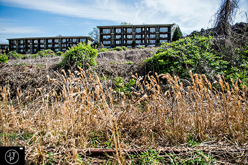
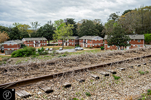
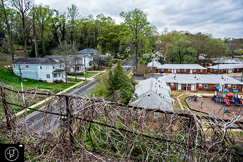
The trail overlooks the Capitol View Apartments and Fleet Repair Solutions.
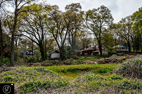
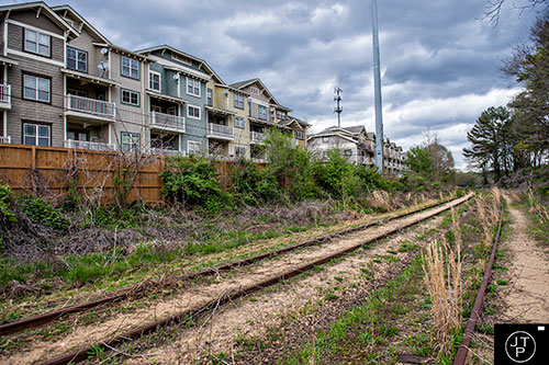
Houses along Erin Ave. back up to the trail.

Worn paths in the dead underbrush can be seen nearing Metropolitan Parkway.
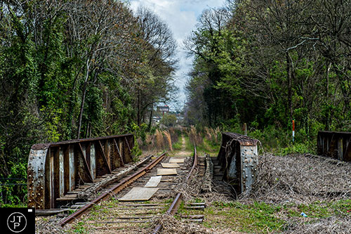
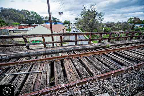
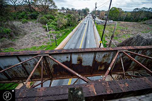
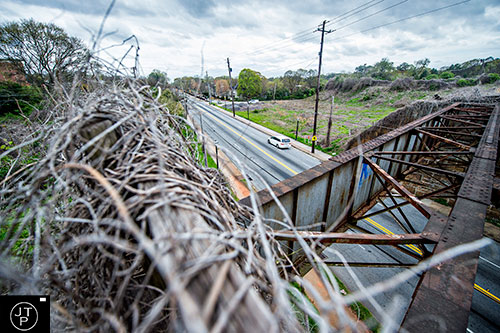
The first of many bridges. This one crosses Metropolitan Parkway.
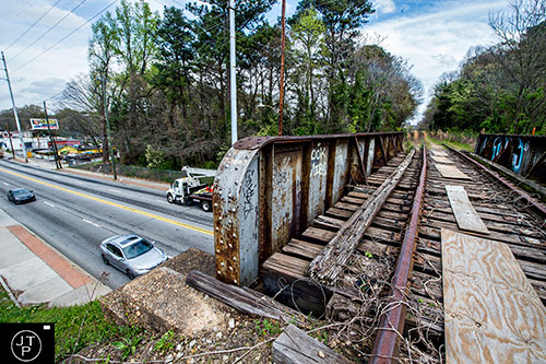
Plywood covers some gaps in the bridge over Metropolitan as traffic travels underneath.

Graffiti marks the bridge over Metropolitan looking south down the road.
The trail continues past Metropolitan.
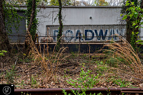
The back side of some warehouse space that Google Maps has listed as Faders Atl., a recording studio, although it looks abandoned.
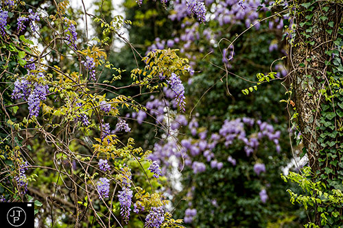
Spring is starting along the trail as flowers start to bloom in hues of purple.

The future home of the Annie E. Casey Foundation sits along the path for the Southside Trail.

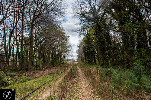
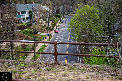
Downtown skyscrapers can be seen in the distance as the trail follows University Ave.
Construction and demolition has begun around the shell of the building at the future site of the
Annie E. Casey Foundation.

Graffiti along the backside of the same property.
Looking back down the trail on the other side of the building.
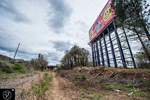
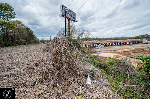
A billboard rises as the trail nears the I-85 overpass.
A small out building on the Sam and Son Wholesale property that backs up to the trail.
BeltGrind is carved into a set of leanto tree branches across the path before the I-85 overpass.
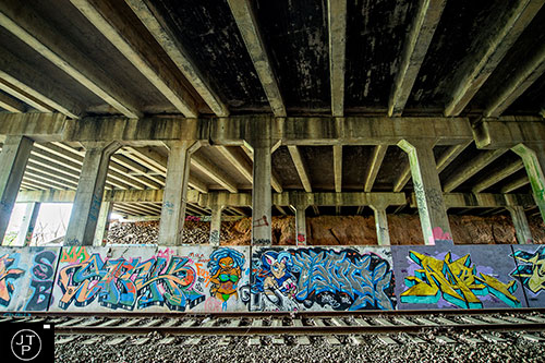
Lots of fun graffiti underneath the I-85 overpass.
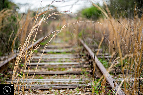
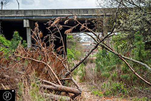
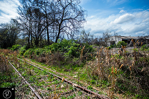
Tall grass along the tracks past the overpass.
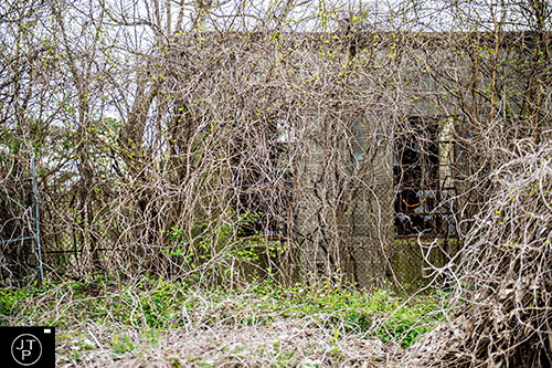
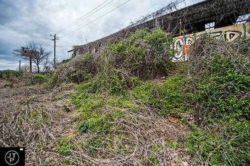
An abandoned building that can be accessed from Manford Rd. is covered over in vines and brush.
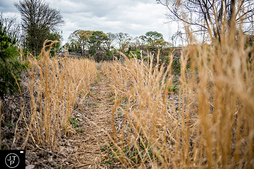
The trail continues through more tall grass towards Pryor St.
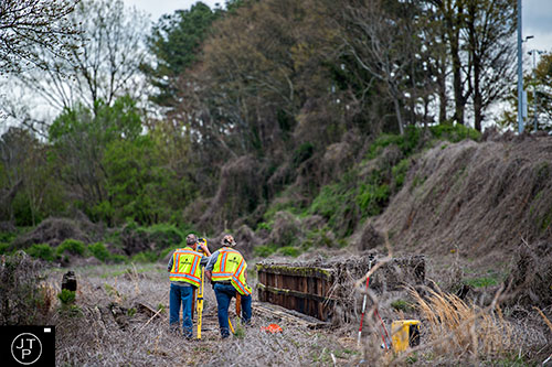
A survey crew works at the bridge crossing over Pryor.
Halfway across the bridge over Pryor St. looking towards the city.
T.H. Slater Elementary School can be seen on the hill to the left off of Pryor St.
Pryor St. is a possible access point for the trail.
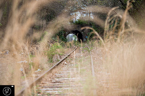
The stone bridge that is has an active rail line that crosses over it. One of the best features of the Southside Trail.
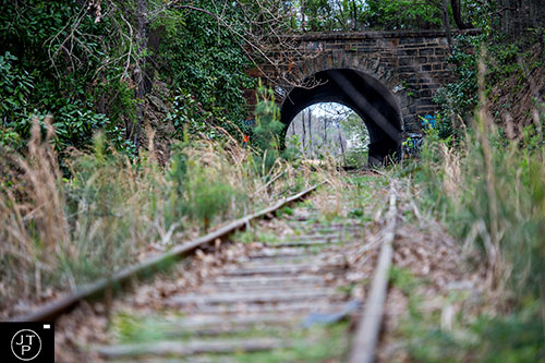
The tall grass gives way to more stable ground closer to the tunnel.

Tree roots snake down the exposed ledge nearer to the tunnel.
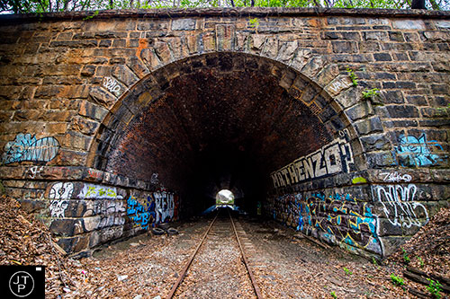
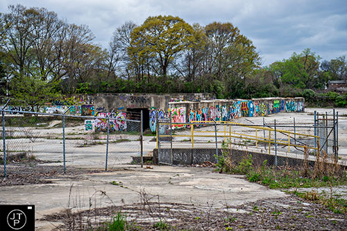
Graffiti marks the entrance of the tunnel as rays of light stream in through the far side.
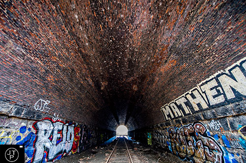
Detailed brick work went into making this tunnel last through the years.
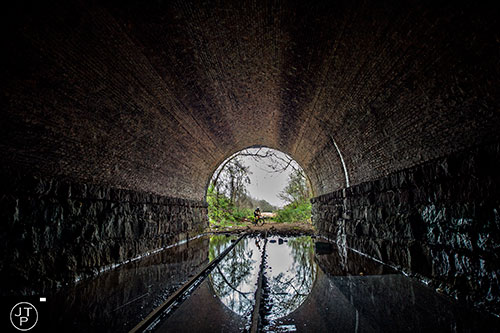
A biker decides to turn around instead of braving the flooded end of the tunnel.
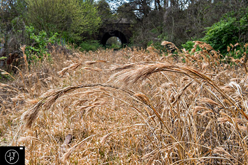
Looking back towards the tunnel from the far side through more tall grass.
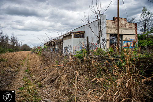
One of the graffiti-covered abandoned buildings nearing the intersection of Milton Ave.
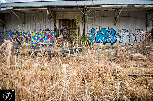
Photo: Jonathan Phillips
One of the graffiti-covered abandoned buildings nearing the intersection of Milton Ave.
Flowers grow along the tracks.
The abandoned building as the trail crosses Milton Ave.
An old warehouse set back from Milton Ave. can be seen from the trail.
The back side of Hill Street Lofts overlooks this section of the Southside Trail.
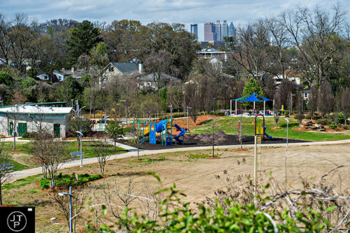
D.H. Stanton Park can be seen from the trail as well as the city in the background.

Homes at the end of Grant Terrace may be getting an access point into the trail.

The trail crosses over Hill St.
Another switch box looking up to the back of another building.

Looking down on the ACC Wholesale property and possibly a very large sink hole.
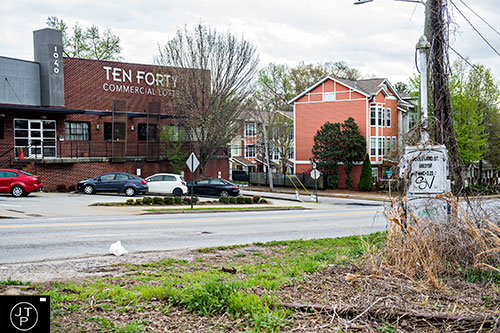
The trail as it crosses Boulevard at the 1040 Commercial Lofts and the adjacent townhomes.

The Cold Storage building at Boulevard could turn in to something amazing.
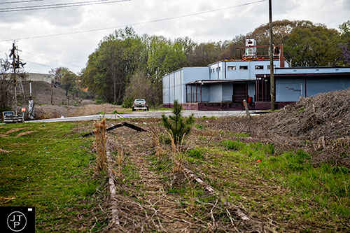
A wider view of the Cold Storage building and the Boulevard crossing looking back the way we just came.
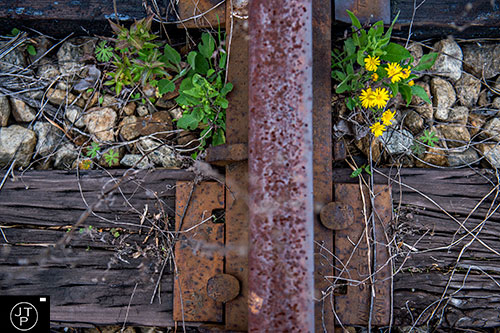
An old piece of railroad equipment and signage.
The backside of The Burnett at Grant Park overlooks a section of trail.
Trestletree Village Apartments can be seen from the trail.
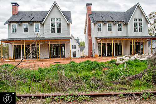
Someone has the right idea. New home construction going up litteraly right off of the trail.
The trail crosses over Ormewood Ave.
Another view of the Trestletree Village Apartments along the trail.
The last house on Vera backs up to the trail.
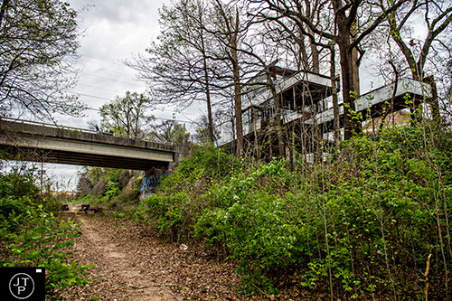
The Atlanta Loft Treehouse overlooks the trail from above on Berne St.
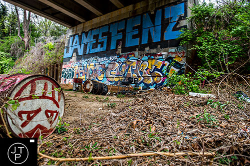
Barrels and graffiti underneath the Berne St. overpass.
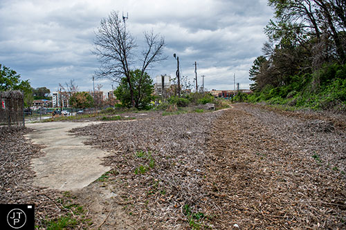
The last tenth of a mile before hitting Glenwood.
Graffiti covered walls behind Maynard Jackson High School.